Practice case study
Extreme weather mapping tool (Leeds)

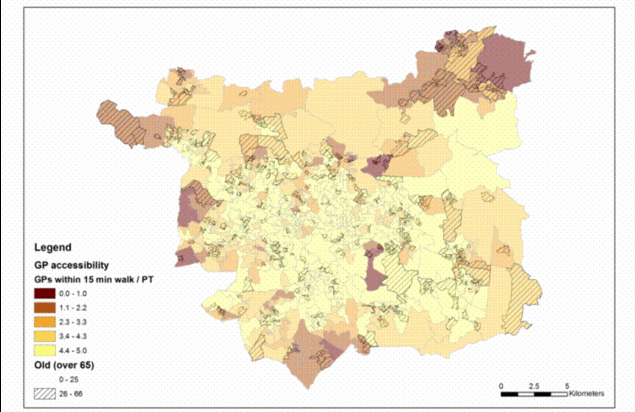
Map graphic from Leeds City Council showing overlay of areas where over 25% of residents are 65 or older with statistics reflecting number of GP centres available within a 15 minute walk or travel by public transport
The aim of this project was to create a GIS mapping tool that would allow partners within and outside of Leeds City Council to prepare for and respond to climate change related extreme weather and which could be transferred to the remaining core cities and other areas. The tool was intended to serve two functions:
- Strategic planning: including data at neighbourhood level, allowing a wide range of teams within the Council and outside voluntary sector organisations to highlight neighbourhoods at greater risk and help them to prepare vulnerable residents for severe weather
- Emergency Response: restricted to Leeds City Council Peace and Emergency Planning Unit and Category 1 Responders, such as the ambulance and fire and rescue services, and containing data on the location of individual vulnerable households likely to be in need of rescue in the event of an emergency situation.
Local Authority


