Tenants in social or private rented housing: where can they be found?
The Climate Just map tool contains a series of maps which can be used to understand patterns in the concentrations of tenants across England, Scotland and Wales.
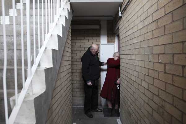
Credit: JRF/Liz Hingley
The tool also allows users to overlay maps of potential exposure to flooding and heat-waves. See the map tool for the national maps for 2011 and to view the proportions of private & social tenants in your area. The headlines below use data from England, but many of the same issues are found in Wales and Scotland. The specific patterns of people renting in Wales and Scotland can be reviewed using our Map Tool. Additional data on housing in Wales and Scotland can be found separately.
Private and social renters tend to live in urban areas, where high temperatures may be further raised by the urban heat island effect (and potentially increased exposure to surface water flooding). In city centres in England, 46% of housing is privately rented and 19% socially rented. In other urban centres, 29% is privately rented and 25% socially rented.1 Taking London as a whole, a quarter of all households live in privately rented accommodation.2
High percentages of social landlords tended to be concentrated in urban areas in 2001. The percentage of social landlords decreased by 1.6% across England between 2001 and 2011. Taking council and social landlords together there was a decrease of 2.6%. Three decades ago 30% of housing was in the socially rented sector, in comparison to just 17% in 2010/11 according to the English Housing Survey. During the same period there has been a marked increase in private landlords.
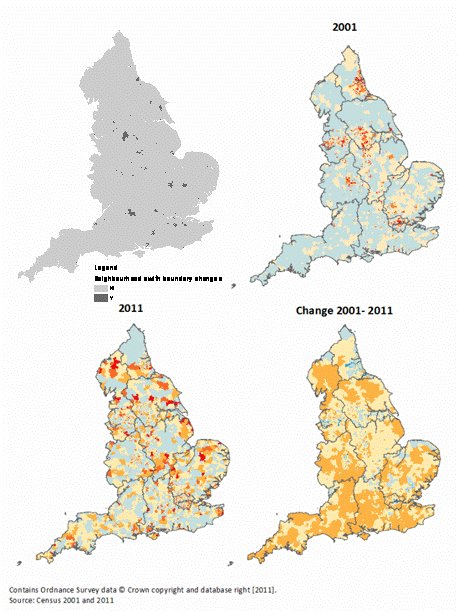
Map 1. Social and Council Landlords 2001 - 2011
Private renting is one of the indicators of social vulnerability which has been particularly growing over recent years.Overall there was an increase of 7% across England from 2001-2011.There is a wide variation at the local scale ranging from 2% to 74% in 2011 (Figure 11). Some of the largest increases were in Peterborough, Milton Keynes and Northampton.
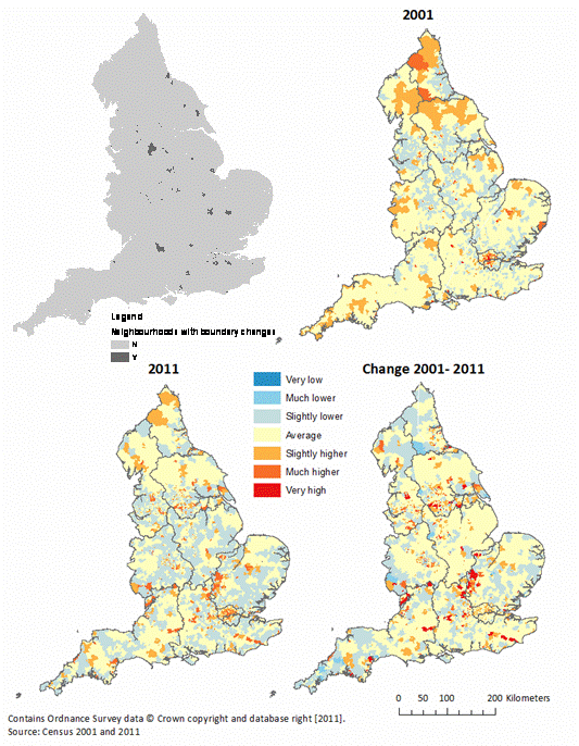
Map 2. Private Renting 2001 - 2011
See the map tool for more information.
References
- DCLG (2013) English Housing Survey 2011-12. Office for National Statistics
- Proposed review: London’s private rented sector

Built by:
![]()
© 2014 - Climate Just
Contact us